Tuesday, September 18, 2012

St Bees to Ennerdale Bridge - (Day 1)


Suddenly this magnificent profile with it's jutting determined chin,
petulant lower lip, furrowed brow, bushy hair and craggy hooked
 nose emerged from the morning sea mist.
This most famous 'Roman Nose' in the British Isles is found
dripping on the cliffs between St Bees and Birkham's Quarry.

Click on the photograph to enlarge


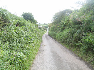
We left the coastal path and headed eastwards along this
quiet stretch of high hedged country road.


Just beyond Moor Row village we entered a narrow
lane, passing through a series of 'kissing gates' leading
to the rural hamlet of Cleator.


Our first obsticl would be Dent Hill. The sight of it alone
stiffened the sinus, furrowed the brow and brought forth
unutterable words of dismay.


From the top of Dent Hill there is a splendid all round view of the
coastal plain below. This is looking vaguely north west towards
the distant coast of Northern Ireland.


The Dent Hill Cairn with a westerly aspect towards St Bees
and the Isle of Man beyond (masked from view by the sea mist) 


Looking northerly towards the entry to the Solway Firth.  


West-South-West. The Sellafield nuclear plant can be seen
on the coast. 


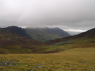
The Lake District starts here! A backdrop of mountain peaks under
heavy skies would be our landscape to explore for the next few days.


A 'long' view of the same scene, leaves us full of hopes and dreams. 


The path ahead was a flat bog., nowhere near as treacherous
as might be imagined.


The steep decent from Flat Fell by Raven Crag to Nannycatch Gate. 


The sheltered valley cut by Nannyccatch Beck was a delight
of warmth that suited plants that could not survive on the
open hillside.  


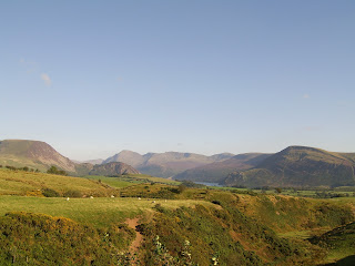
Our first close-up glimpse of the mountainous Lake District
and a lake, Ennerdale Water. The near ground was warm,
occupied and inviting. The mountainous background
appeared bleak, rugged and uninviting.


As can be seen, the view from our digs was splendid and tranquil. 

Saturday, September 15, 2012

Ennerdale Bridge to Rothswaite


All dressed up and a long way to go.

Click on photograph to enlarge


Approaching Ennerdale Water overshadowed by the heights of Grag Fell
which is enjoying the caress of low soft cloud. 


Early morning trampers enjoying a stroll besides the lake of
Ennerdale Water, beneath the towering heights of Angler's Crag.


The path follows the water's edge to the point which is
Robin Hood's Chair. 


The northern boundary of the lake touches the sky. 


The long view of Ennerdale Water and a 'typical' Lake District sky. 


The morning remained overcast and dark. Fortunately there
was little wind to enliven the occasional showers. 


From the 'lookout' of Robin Hood's Chair towards the head of
the lake which is our objective.


The uninviting thrust of Angler's Crag from where even the most
ambitious  fisherman would be unlikely to catch anything other
than a cold.


The misty valley down which flows the River Liza to lift the
level of Ennerdale Water. Our path is the cart track on the right. 


The 'King of the Valley', a magnificent erratic bolder, has
kept watch over this place for more than ten thousand
years - since the last Ice Age. The King is a rather plumb
gentleman who would turn the scales at several hundred
tons. 


A stream running down from the high peaks of Red Pike, High Stile,
High Crag or the Hay Stack, a route denied to us by the thick
mountain mist.


Several peaks off to the south. 


Our first sighting of Black Sail YHA hostel glimmering in the
near distance. Here we feasted on hot tea and cake amongst a
 steaming mod of red faced fellow trampers.


The path leading towards the near vertical climb known as
Seavy Knott which follows the tumbling waters of Loft Beck.


Looking back westwards towards Ennerdale Water to
where the cascading flow of Loft Beck is heading. The
path may be seen on the left running around the flank
of the hill.


From the tops, beneath Brandreth and Grey Kotts, looking
north to Fleetwith Pike where the land falls away to Buttermere,
the lake in the distance. 


Beyond Fleetwith Pike the hillside is scarred by a hard rock quarry. 


The mist lifted exposing the high route across Red Pike,
High Stile, Comb Crags, High Grag, Scarth Gap and High
Stacks. We'd save that walk for another day.


Rothswaite to Grasmere


The higher we went the more the mist played touch and go.
In this snap the mist had gone up the mountains like a robin in summer.

Click on photograph to enlarge 


Visibility remained reasonable for most of the morning.
By lunchtime it had cleared and the sun showed it's face. 


On the lower reaches of the mountains sheep could graze and
trees survive. Eagle crag dominates all. 


The waterfall near the base of Stonethwaite Beck and the
confluence with Langstrath Beck. 


The anthem for the Lake District should be
'Water,Water, Everywhere'. 


Sturdy mountain sheep maintain their chilly vigual  when not on
their knees grazing the tough high altitude grasses.


Eagle Crag and not a bird in sight. The three trampers on the
left may be used to gauge the scale of the surroundings. 


Looking east towards Rothswaite under a broken sky with
the sun starting to move in.


Rough rocky terrain, but who cares the sun is shinning. 


Down comes the mist again and no doubt bringing
a little rain also. 


The path ahead looks steep and uninviting, but 'never say die',
it's only another hill to climb. 


It pays to be doubly careful walking on these paths.
Also, waterproof boots are recommended. 


A long damp valley with humped 'drumlins' for us to
walk across and around. 


In places the 'path' is quite loose underfoot. 


The valley floor covered in drumlins.
Drumlins were formed when the last Ice Age melted away. 


Drumlins are a spectacular  sight, well worth a break from the
 tramp, tramp, tramp of the 'must get there on time' brigade.


Onward, ever onward marched the intrepid two. 


And then the sun broke through and the path became less
challenging, although still a rivulet. 


Looking west towards the drumlin basin. 


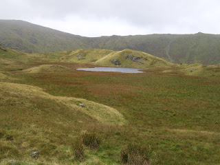
In the Lake District there are many pools of water apart
from the well known 'Lakes'. 


An adjacent ridge somewhere along the route. 


The narrow entry to Far Easedale. Just before this place most
trampers were lost or confused about which way to go next.


The path leading to the magnificent ridge which is the last leg
of our walk to Grasmere 


Even through the mist the tortured history of the mountains
is clearly seen in the rock face.


"Lost!  Not on your life."
"Don't forget: 'Four legs good. Two legs bad'". 


The view from near Calf Crag into the Easedale Valley far below. 


The 'Ridge', like a stupendous sleeping monster. 


A valley leading off to the north. 


Another view of the Easedale Valley 


Our first glimpse of Grasmere Lake. 


The erosion on the left of the picture is thanks to trekkers.
The other erosion, off the path, may be thanks to the local
inhabitants - sheep. 


Possibly the most splendid ridge in the British Isles. 


The Easedale Beck meandering towards the Grasmere Lake. 


The enormous threatening 'lump' which is Gibson Knott. 


The northern valley from Gibson Knott. Also, in the foreground,
the edge down which we had to tramp. 


The southern valley from Gibson Knott. 


Once again the sun returned and we entered civilisation.